
Full resolution (TIFF) - On this page / på denna sida - Fjärde perioden (De stora upptäckternas tid 1492 - omkr. 1600)
<< prev. page << föreg. sida << >> nästa sida >> next page >>
Below is the raw OCR text
from the above scanned image.
Do you see an error? Proofread the page now!
Här nedan syns maskintolkade texten från faksimilbilden ovan.
Ser du något fel? Korrekturläs sidan nu!
This page has been proofread at least once.
(diff)
(history)
Denna sida har korrekturlästs minst en gång.
(skillnad)
(historik)

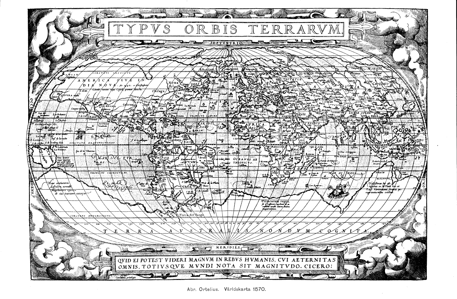
Abr. Ortelius. Världskarta 1570.
<< prev. page << föreg. sida << >> nästa sida >> next page >>