
Full resolution (JPEG) - On this page / på denna sida - NYARE TIDENS HISTORIA
<< prev. page << föreg. sida << >> nästa sida >> next page >>
Below is the raw OCR text
from the above scanned image.
Do you see an error? Proofread the page now!
Här nedan syns maskintolkade texten från faksimilbilden ovan.
Ser du något fel? Korrekturläs sidan nu!
This page has been proofread at least once.
(diff)
(history)
Denna sida har korrekturlästs minst en gång.
(skillnad)
(historik)
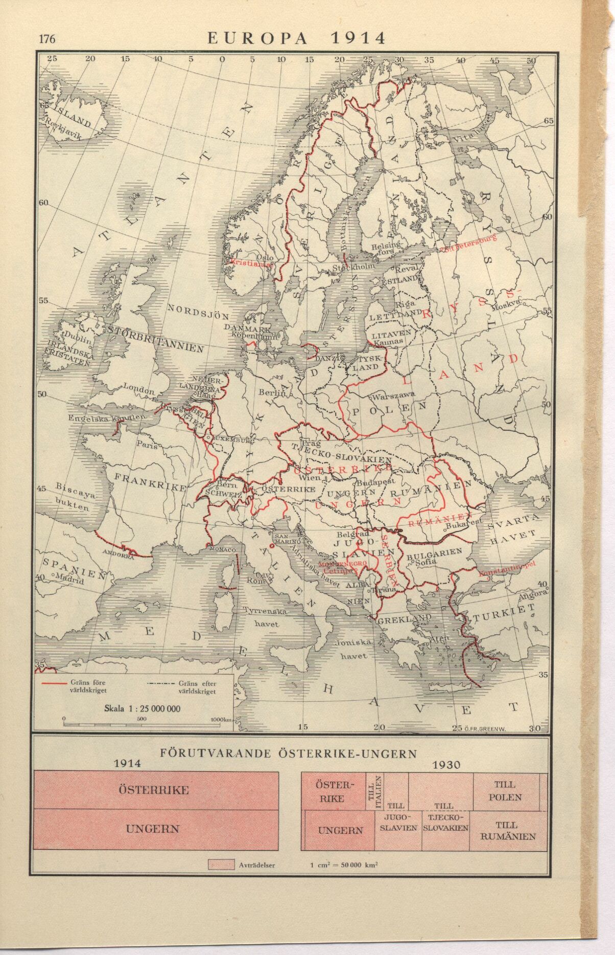
EUROPA 1914
FÖRUTVARANDE ÖSTERRIKE-UNGERN
1914 1930
| t "" ’j Avträdelser l cm2 = 50 000 ki
<< prev. page << föreg. sida << >> nästa sida >> next page >>