
Full resolution (JPEG) - On this page / på denna sida - Etälä-Ameriikka
<< prev. page << föreg. sida << >> nästa sida >> next page >>
Below is the raw OCR text
from the above scanned image.
Do you see an error? Proofread the page now!
Här nedan syns maskintolkade texten från faksimilbilden ovan.
Ser du något fel? Korrekturläs sidan nu!
This page has never been proofread. / Denna sida har aldrig korrekturlästs.
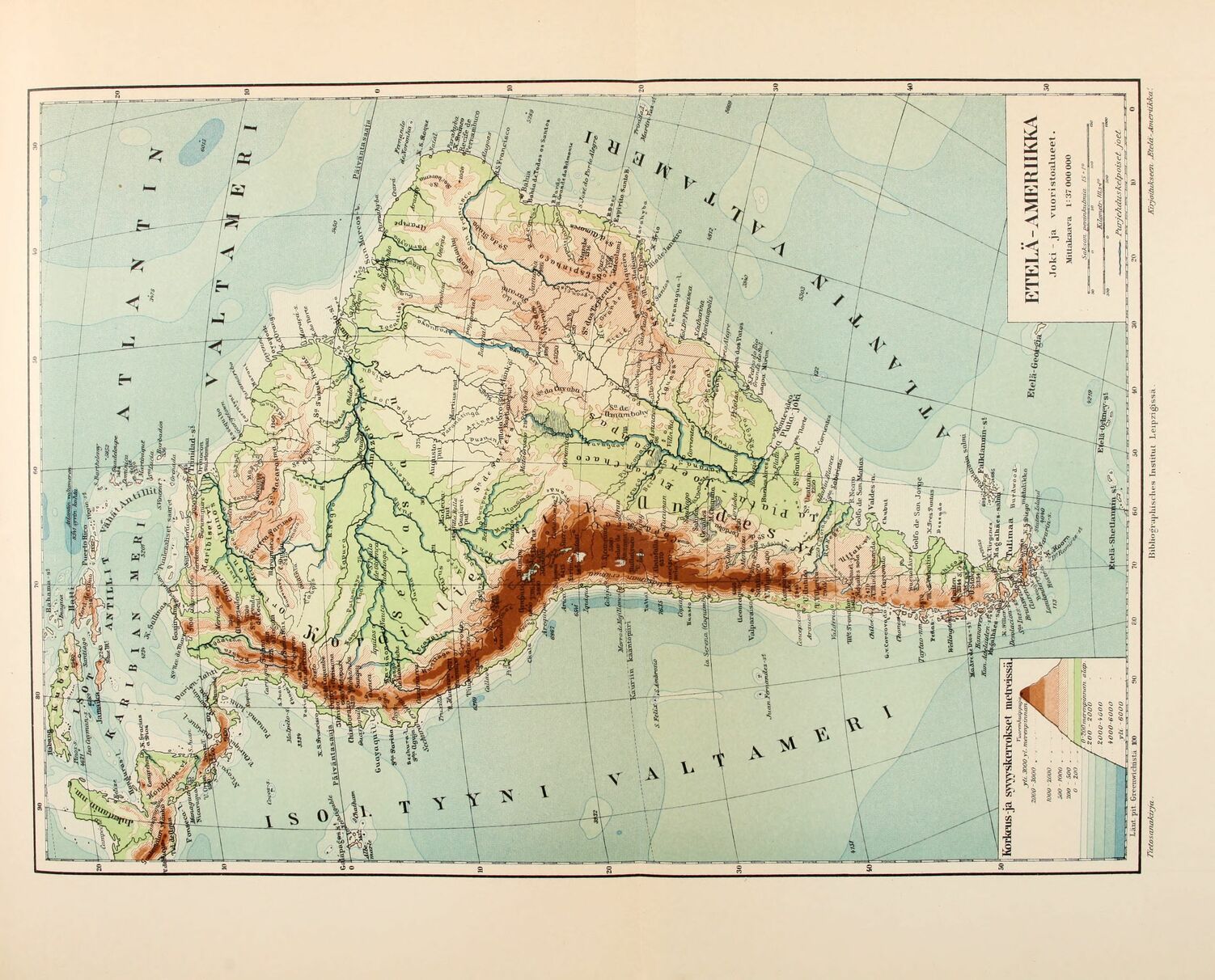
Korkeus ja s^yskErrokset molreissä.
Vuomiltuifi/iuji^^.
jrti 3000yi. merenpinnanÆfk
2000-3000 . .
ETELÄ-AME RIIKKA
Joki
vuoristoalueet
Mittakaava l: 37 000 000
SaAsa/i pann/atinua /S * /°
KilomeO’ //te-/’
PiayeJutus kelpoiset Joet
Laiit. pit Greenwichistä 100
Tietosaruikuya . Bibliogruphisrhes Institut Leipzigissä. Kuyoitukseen Melä-Ameriikka:
<< prev. page << föreg. sida << >> nästa sida >> next page >>