- Project Runeberg -  Through Norway with Ladies /
72

(1877) [MARC] Author: W. Mattieu Williams
Table of Contents / Innehåll | << Previous | Next >>
  Project Runeberg | Catalog | Recent Changes | Donate | Comments? |   

Full resolution (JPEG) - On this page / på denna sida - Sidor ...

scanned image

<< prev. page << föreg. sida <<     >> nästa sida >> next page >>


Below is the raw OCR text from the above scanned image. Do you see an error? Proofread the page now!
Här nedan syns maskintolkade texten från faksimilbilden ovan. Ser du något fel? Korrekturläs sidan nu!

This page has been proofread at least once. (diff) (history)
Denna sida har korrekturlästs minst en gång. (skillnad) (historik)

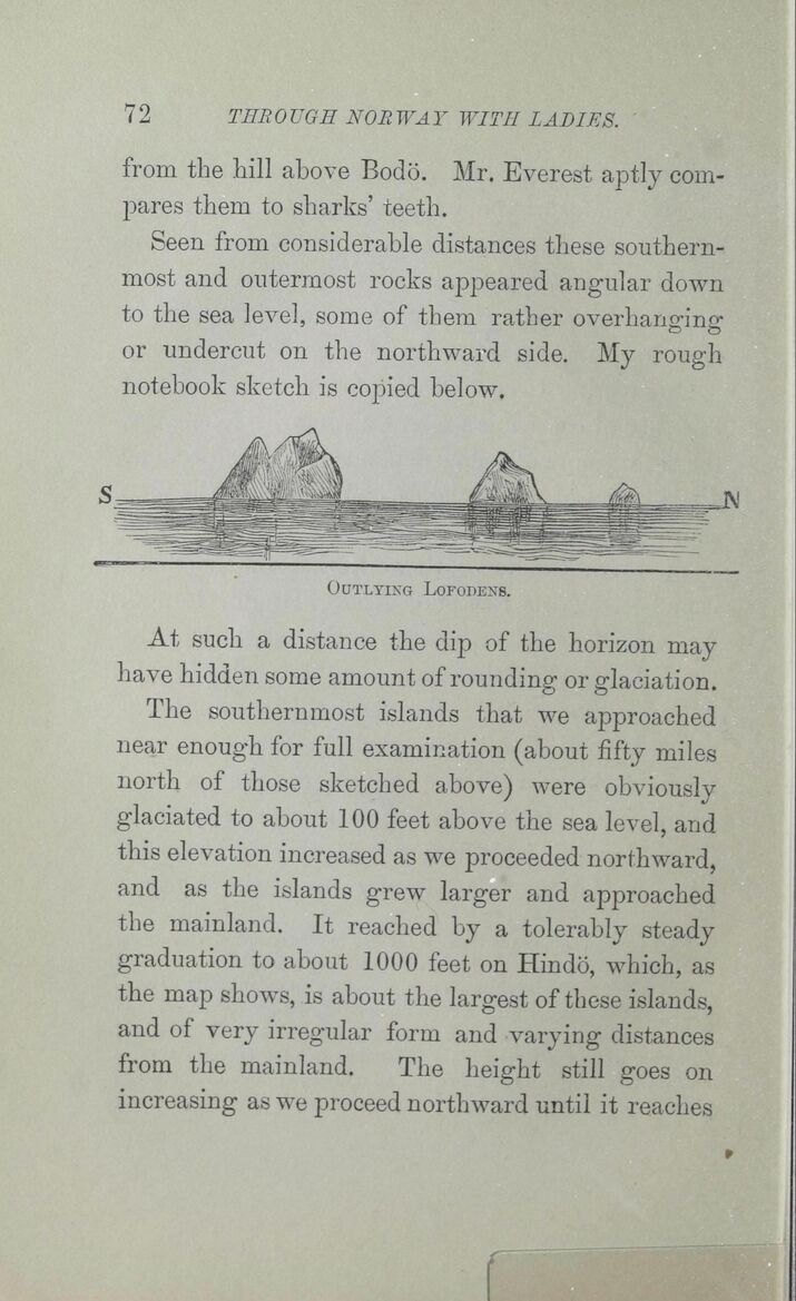
from the hill above Bodö. Mr. Everest aptly
compares them to sharks’ teeth.

Seen from considerable distances these
southernmost and outermost rocks appeared angular down
to the sea level, some of them rather overhanging
or undercut on the northward side. My rough
notebook sketch is copied below.

<span class=
Outlying Lofodens.


At such a distance the dip of the horizon may
have hidden some amount of rounding or glaciation.

The southernmost islands that we approached
near enough for full examination (about fifty miles
north of those sketched above) were obviously
glaciated to about 100 feet above the sea level, and
this elevation increased as we proceeded northward,
and as the islands grew larger and approached
the mainland. It reached by a tolerably steady
graduation to about 1000 feet on Hindö, which, as
the map shows, is about the largest of these islands,
and of very irregular form and varying distances
from the mainland. The height still goes on
increasing as we proceed northward until it reaches

<< prev. page << föreg. sida <<     >> nästa sida >> next page >>


Project Runeberg, Tue Dec 12 14:41:12 2023 (aronsson) (diff) (history) (download) << Previous Next >>
https://runeberg.org/withladies/0100.html

Valid HTML 4.0! All our files are DRM-free