
Full resolution (TIFF) - On this page / på denna sida - N:o 2 - Pages ...
<< prev. page << föreg. sida << >> nästa sida >> next page >>
Below is the raw OCR text
from the above scanned image.
Do you see an error? Proofread the page now!
Här nedan syns maskintolkade texten från faksimilbilden ovan.
Ser du något fel? Korrekturläs sidan nu!
This page has never been proofread. / Denna sida har aldrig korrekturlästs.
FENNIA 66, N:o 1
17
Towards the north this water plane rises fairly rapidly, attaining
a height of 200 m. within a zone where the first Yoldia lies at 120 m.
Southwards it correspondingly sinks to 100 m. near Sortavala on the
northern coast of Lake Ladoga, and to 50 m. in Salmi east of the
same lake. At Sortavala the Yoldia again has a height of 50 m. As the
shore-line in question has been marked in .the new diagram according
to these observations, it shows a fairly great degree of tilting in
relation to the succeeding water planes, formed during the Salpausselkä
stages. One would perhaps expect to find in this wide angle a great
difference in age between the shore-lines; but such is not the case.
During the first ice-lake stage the ice margin had retreated already
very near to the first Salpausselkä moraine. Thereafter the water
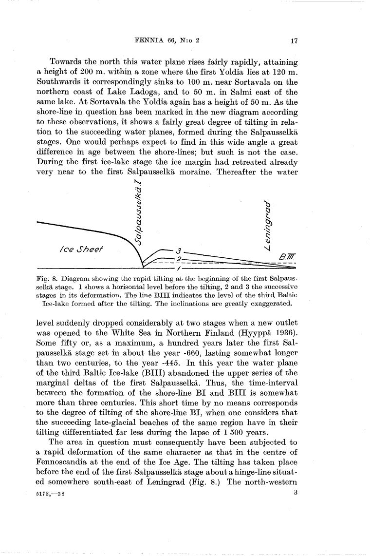
Fig. 8. Diagram showing the rapid tilting at the beginning of the first
Salpausselkä stage. 1 shows a horisontal level before the tilting, 2 and 3 the successive
stages in its deformation. The line Bill indicates the level of the third Baltic
Ice-lake formed after the tilting. The inclinations are greatly exaggerated.
level suddenly dropped considerably at two stages when a new outlet
was opened to the White Sea in Northern Finland (Hyyppä 1936).
Some fifty or, as a maximum, a hundred years later the first
Salpausselkä stage set in about the year -660, lasting somewhat longer
than two centuries, to the year -445. In this year the water plane
of the third Baltic Ice-lake (Bill) abandoned the upper series of the
marginal deltas of the first Salpausselkä. Thus, the time-interval
between the formation of the shore-line BI and Bill is somewhat
more than three centuries. This short time by no means corresponds
to the degree of tilting of the shore-line BI, when one considers that
the succeeding late-glacial beaches of the same region have in their
tilting differentiated far less during the lapse of 1 500 years.
The area in question must consequently have been subjected to
a rapid deformation of the same character as that in the centre of
Fennoscandia at the end of the Ice Age. The tilting has taken place
before the end of the first Salpausselkä stage about a hinge-line
situated somewhere south-east of Leningrad (Fig. 8.) The north-western
5172,-38 3
<< prev. page << föreg. sida << >> nästa sida >> next page >>