
Full resolution (JPEG) - On this page / på denna sida - Seiten ...
<< prev. page << föreg. sida << >> nästa sida >> next page >>
Below is the raw OCR text
from the above scanned image.
Do you see an error? Proofread the page now!
Här nedan syns maskintolkade texten från faksimilbilden ovan.
Ser du något fel? Korrekturläs sidan nu!
This page has been proofread at least once.
(diff)
(history)
Denna sida har korrekturlästs minst en gång.
(skillnad)
(historik)
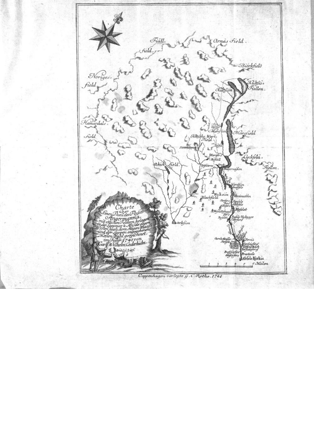
This page should have been folded out to show the map Carl Wilhelm Cederhielm made in 1741. This is the map that is missing and should have been scanned: https://dfg-viewer.de/show?tx_dlf%5Bdouble%5D=0&tx_dlf%5Bid%5D=https%3A%2F%2Fwww.zvdd.de%2Fdms%2Fmetsresolver%2F%3FPPN%3Durn%3Anbn%3Ade%3Ahbz%3A6%3A1-10716&tx_dlf%5Bpage%5D=17&cHash=771a91cf8f93fbb1e8674cdcb698688f
It’s a crucial map, because it was thought to be the first depiction of a skier with two ski poles.
<< prev. page << föreg. sida << >> nästa sida >> next page >>