
Full resolution (JPEG) - On this page / på denna sida - DELAR AV JÄTTESTÄDER
<< prev. page << föreg. sida << >> nästa sida >> next page >>
Below is the raw OCR text
from the above scanned image.
Do you see an error? Proofread the page now!
Här nedan syns maskintolkade texten från faksimilbilden ovan.
Ser du något fel? Korrekturläs sidan nu!
This page has been proofread at least once.
(diff)
(history)
Denna sida har korrekturlästs minst en gång.
(skillnad)
(historik)
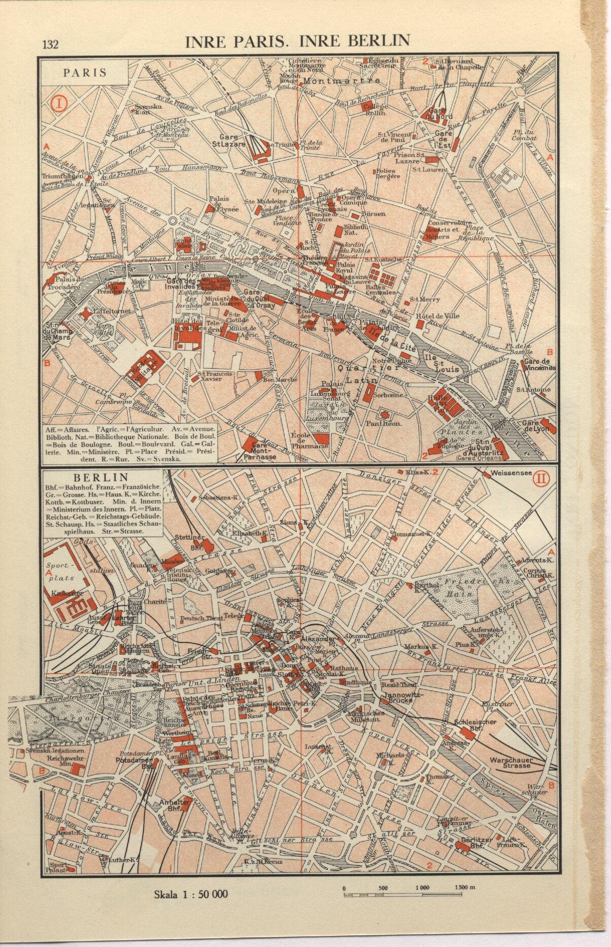
INRE PARIS. INRE BERLIN
. Aftaires. l’Agric. = l’Agricultur. Av. = Avenue.
Biblioth. Nat.=Bibliotheque Nationale. Bois de Boul,
= Bois de Boulogne. Boul.=Boulevard. Gal. =
Gal-lerie. Min.-Ministere. Pl. = Place Présid.=
President. R.=Rue. Sv.-Svenska
Bhf.=Bahnhof. Franz. = Französiche
Gr. = Grosse. Hs.=Haus.K.=Kirche.
Kottb.=Kottbuser. Min. d. Innern
= Ministerium des Innern. Pl.=Platz.
Reicbst-Geb. = Reichstags-Gebäude.
St. Schausp. Hs. = Staatliches
Schau-spi elhaus. Str. = S trasse.
Skala l : 50 000
1000 1500n
<< prev. page << föreg. sida << >> nästa sida >> next page >>