
Full resolution (JPEG) - On this page / på denna sida - Sidor ...
<< prev. page << föreg. sida << >> nästa sida >> next page >>
Below is the raw OCR text
from the above scanned image.
Do you see an error? Proofread the page now!
Här nedan syns maskintolkade texten från faksimilbilden ovan.
Ser du något fel? Korrekturläs sidan nu!
This page has never been proofread. / Denna sida har aldrig korrekturlästs.
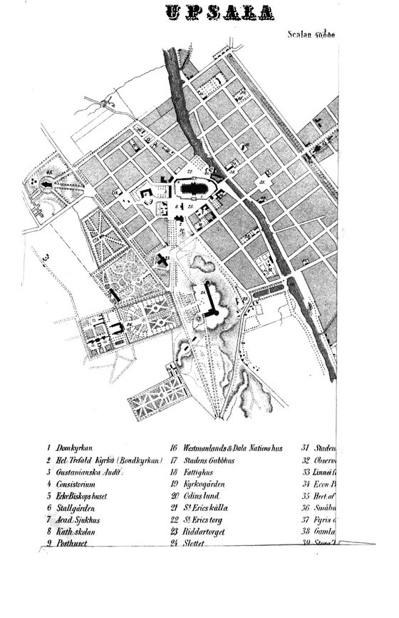
1 Domkyrkan 16 Watmanlands&Jkla Nationshus 31 .Staden
2 ffcl Trefa}d kyrkå (Boftdkyrkau) 17 Stadens Oubbhus 32 Obserol
3 Gustavianska Judit. 18 Fattighus 33 Linnei ft
4 Cnnsistorinm 19 kyrkogarden 34 Econ.lj
5 ErkeBiskops huset 20 Odins lun d 35 Bert.aÅ
6 Stall (jun/en ‘it St Erics kall a 36 Småhn
7 Jea d: Sjukhus 22 St Erics torg 37 Fyris A
8 ha/h skolon 23 Riddartorget 38 GcanlÅ
.9 Badhuset _______________ is .ISLStauA
b
1
t
V9SAJUL
<< prev. page << föreg. sida << >> nästa sida >> next page >>