- Project Runeberg -  Amerika, dess upptäckt, eröfring och fyrahundraåriga utveckling /
plansch vid 192

(1892) [MARC] Author: Otto Wilhelm Ålund - Tema: Americana, Geography
Table of Contents / Innehåll | << Previous | Next >>
  Project Runeberg | Catalog | Recent Changes | Donate | Comments? |   

Full resolution (TIFF) - On this page / på denna sida - 10. De tretton kolonierna - Kartor på särskilda blad
scanned image

<< prev. page << föreg. sida <<     >> nästa sida >> next page >>


Below is the raw OCR text from the above scanned image. Do you see an error? Proofread the page now!
Här nedan syns maskintolkade texten från faksimilbilden ovan. Ser du något fel? Korrekturläs sidan nu!

This page has been proofread at least once. (diff) (history)
Denna sida har korrekturlästs minst en gång. (skillnad) (historik)

illustration placeholder
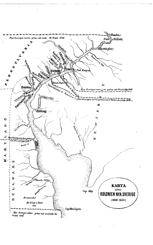
KARTA öfver KOLONIEN NYA SVERIGE (1638-1655)

<< prev. page << föreg. sida <<     >> nästa sida >> next page >>


Project Runeberg, Sat Dec 9 22:54:14 2023 (aronsson) (diff) (history) (download) << Previous Next >>
https://runeberg.org/erofring/0229.html

Valid HTML 4.0! All our files are DRM-free